


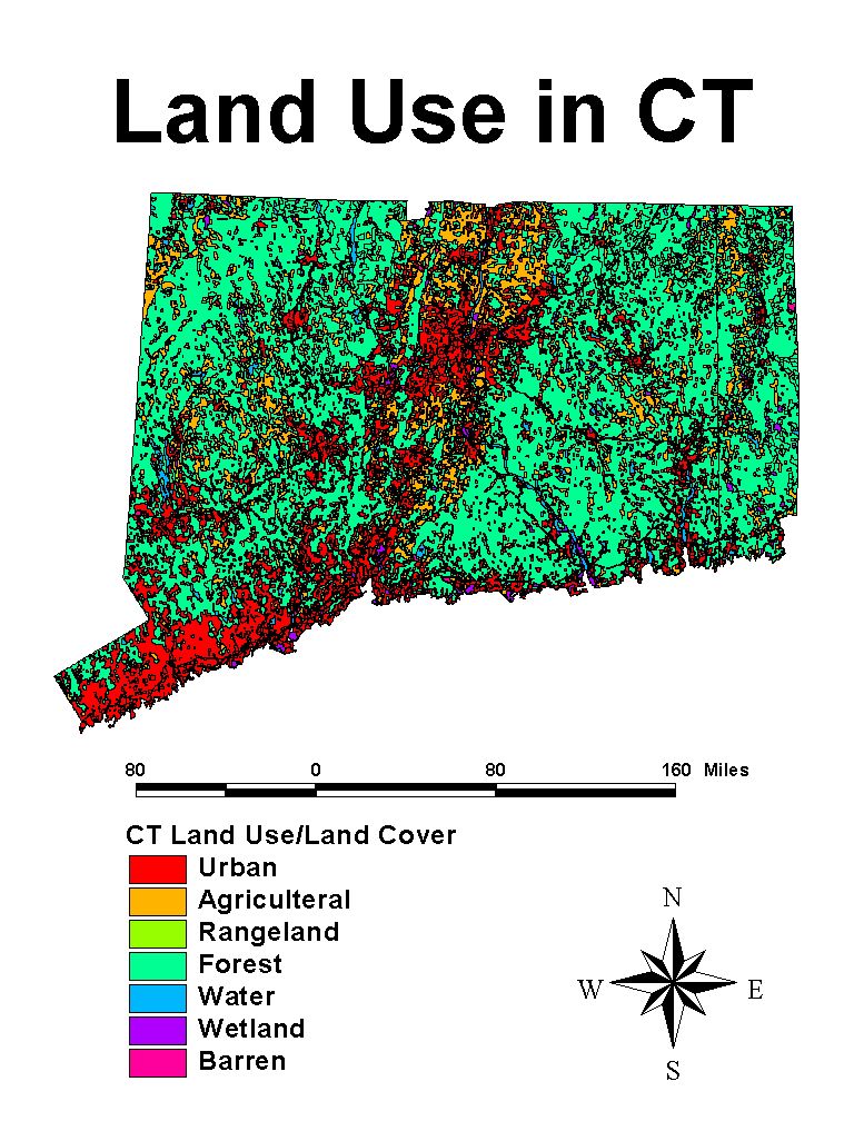
GIS produce high quality graphics:
How to present the information is another issue entirely! ArcView provides a ``Layout'' feature, which allows one to compose a plot, adding a legend, scale, title, etc. Creating a map like this is very quick. But has the ability to make maps quickly and easily also made us careless? For example, because I accepted all the defaults ArcView assumed that my units were miles, and produced an incorrect scale on the example map....